

SHIVWITS
Emergency Management
SHIVWITS
Emergency Management
Tel: 435-656-9002 ~ Fax: 435-656-8005 ~ Email: Koda@ShivwitsEmergency.org
The Shivwits Band Emergency Management
~Emergency Operations Plan (EOP)~
A plan for coordinating and facilitates resources to minimize the impacts of the emergencies and disasters on its people, pets, animals, personal property, culture sites and plants and its land and natural resources, economy and our environment.

Photo by Shanan Anderson
Shivwits Band Emergency Operations Plan
(S.B.O.P.-E.O.P.)
The Shivwits Band of Paiutes is an independent sovereign Indian tribe recognized by the United States as such beginning in 1891 by 26 Stat. 1005, and formally under the Indian Reorganization Act of June 18, 1934 (48 Stat. 984) on March 21, 1940, and again in 1980 by P.L.96-227, 94. Stat. 317, codified at 25 U.S.C. § 761 et seq.
The Shivwits Band Council has a duly-elected governing body with powers enumerated in Article VIII of the Paiute Tribal Constitution, which give them full authority over the disposition of their band's land and assets.
Therefore, the Shivwits Band Emergency Management team has developed an Emergency Operation Plan (S.B.O.P.-E.O.P.)
The Shivwits Band Council hereby authorizes the Emergency Management Manager or Shivwits Band Chairperson whom serve on the Tribal Council to be the contact between the County Emergency Operation Center and the Shivwits Band.
Operational Priorities
Special Consideration is given to the following priorities when conducting emergency operations:
-
Protecting all forms of life (highest priority), property, and the environment.
-
Meeting the immediate emergency needs of the people, including rescue, medical care, food, shelter, and clothing.
-
Temporarily restoring facilities, whether publicly or privately owned, that are essential to the health, safety, and welfare of people (such as medical, sanitation, water, electricity, & emergency road repair.)
-
Meeting the short-term rehabilitation needs of people, including provision of temporary housing or shelters, food, and employment. (Priority-SBC Board to get the store back up and running.)
-
Mitigating hazards that pose a threat to life, property, or the environment.
Mass Care Purpose of this is setting the Shivwits Gymnasium/Community Building up for shelter and mass care whichever is needed.

Our Mission
As the Manager of the Shivwits Band Emergency Management and (TERT) Tribal Emergency Response Team, it is our responsibility to prepare for and respond to all disasters whether it be natural or man-made events which may threaten the peace and safety of our people, pets, animals, our lands, natural resources and personal property in all our tribal communities.
Also, as the Shivwits Emergency Management and TERT members, we will put forth our best effort to respond to and help recover from natural disasters or an act of terrorism, even if it is done by our own band tribal members.
Additionally, we know that the Band can apply for resources from state, local and federal entities, as well as private and are non-governmental partners. Our compacts with the state, county and Region 8 federal agencies, the private sectors and from non-profit entities have expanded significantly in recent years to include pre-accident preparedness through specialized training, Hazard reduction planning, and exercises with all our partners that can help reduce or prevent the impact of all disasters. As Native Americans and part of the Southern Paiute Nation we may be able to survive on our own for up to 7 days or longer.
Shivwits Land & Environment
Reservation
The Shivwits Reservation has a population of approximately 314 total band members. However, living on the reservation there are only 28 homes with about 110 people whom reside on the reservation. We have Shivwits Band/Tribal members also living inside Saint George, Washington, Hurricane, La Verkin and Ivins cities in tribal homes. Some live in other parts of the state.
Land and Geography
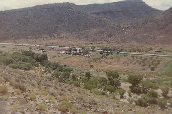
The Shivwits Bands land area is approximately 28,153 acres and located in the very West corner of Washington County. There are two other parcels of land they own, one in St. George and the other in Hurricane, UT. These two parcels will be the future home of to two C-Stores.
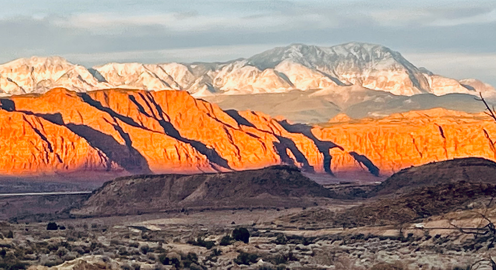
Our terrain varies from high mountain peaks to low sandy desert valleys, with pine & juniper trees in both the higher and lower terrains, rabbit brush & sage brushes of many types, cactus plants and evasive plants taking over in some places. Wildfires have also brought in Black-brush and scrubs. Annual grasses occupy the empty spaces.
We've had three major fires since 2003 that have burnt 19,000 acres and ended inside the reservation, both man caused. Since then we had three more fires lightning caused. Cheat-grass/Red Brome are the dominating plants now.

Photo by Travis Duran
Environment
Our winters and summer seasons are characterized by:
High winds up to 60 miles per hour causing blinding flowing sand, extreme heat and fog, high humidity, rain without warning with lightning strikes causing wildfires, flash flooding and power failures, hail, freezing winds and occasionally snow. Also running through is Highway 91 and the Santa Clara River.
Photo by Travis Duran

